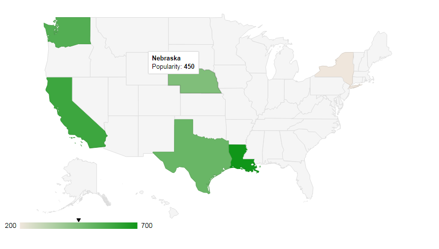
Hello to all, welcome to therichpost.com. Today In this post, I will show, How to show Google Map for particular Country with selected Provinces?
If you new in Google map or you want know more about it then you can check my posts related to Google Maps.
This post is very interesting and I am hoping, you will all like this also very much.

Here is the working code and you can add this into your html file:
<html>
  <head>
    <script type="text/javascript" src="https://www.gstatic.com/charts/loader.js"></script>
    <script type="text/javascript">
      google.charts.load('current', {
        'packages':['geomap'],
        // Note: you will need to get a mapsApiKey for your project.
        // See: https://developers.google.com/chart/interactive/docs/basic_load_libs#load-settings
        'mapsApiKey': 'AIzaSyD-9tSrke72PouQMnMX-a7eZSW0jkFMBWY'
      });
      google.charts.setOnLoadCallback(drawRegionsMap);

      function drawRegionsMap() {
        var data = google.visualization.arrayToDataTable([
            ['Regions', 'Popularity'],
            ['New York', 200],
            ['Texas', 500],
            ['California', 600]

        ]);

         var options = {};
         options['region'] = 'US';
         options['resolution'] = 'provinces';


        var chart = new google.visualization.GeoChart(document.getElementById('regions_div'));

        chart.draw(data, options);
      }
    </script>
  </head>
  <body>
    <div id="regions_div" style="width: 900px; height: 500px;"></div>
  </body>
</html>
If you have any query or you want more advance code related to this, then you can comment below or ask question.
Thank you,
Harjas,
TheRichPost
Leave a Reply
You must be logged in to post a comment.